- Austin, TX
- xyaoaf<at>utexas<dot>edu
- Github
- Google Scholar
- ORCID
 X
X
Teaching
I am passionate about teaching and mentoring the next generation of geospatial scientists and environmental planners. My teaching philosophy emphasizes hands-on learning, real-world applications, and fostering critical thinking skills that empower students to tackle complex environmental challenges.
Instructor of Record
GEOG/LDARCH C188: Geographic Information Science
University of California, Berkeley | Fall 2023
As the instructor of record, I had the privilege of leading UC Berkeley’s largest GIS course, serving over 200 students across multiple disciplines. This was one of the most rewarding and challenging experiences of my academic career, requiring careful course design, team coordination, and dedication to student success.
Course Overview:
- Enrollment: 200+ students from Geography, Landscape Architecture, Environmental Science, Urban Planning, and related fields
- Format: Lectures, hands-on labs, and applied group projects
- Focus: Foundational and advanced GIS concepts, spatial analysis, remote sensing integration, and real-world applications
Key Responsibilities:
- Designed and delivered weekly lectures on GIS theory, spatial data analysis, and geospatial technologies
- Supervised a team of Graduate Student Instructors (GSIs) to ensure consistent and high-quality lab instruction
- Developed course materials, assignments, and assessments that balanced theoretical foundations with practical skills
- Coordinated with 200+ students through office hours, discussion forums, and one-on-one mentoring
- Created final group projects that challenged students to apply GIS methods to real-world environmental and urban planning problems
Teaching Highlights:
- Successfully managed one of Berkeley’s largest courses while maintaining high student engagement and learning outcomes
- Integrated cutting-edge topics including remote sensing, spatial data science, and emerging GIS technologies
- Showcased exceptional student projects through curated galleries:
- StoryMap Collection: Applied Term Projects (StoryMaps) - Interactive web maps demonstrating diverse GIS applications
- StoryMap Collection: Applied Term Projects (Posters) - Professional posters showcasing advanced spatial analysis
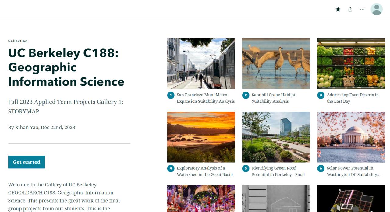
Fall 2023 Applied Term Projects Gallery 1: Student StoryMaps showcasing diverse GIS applications
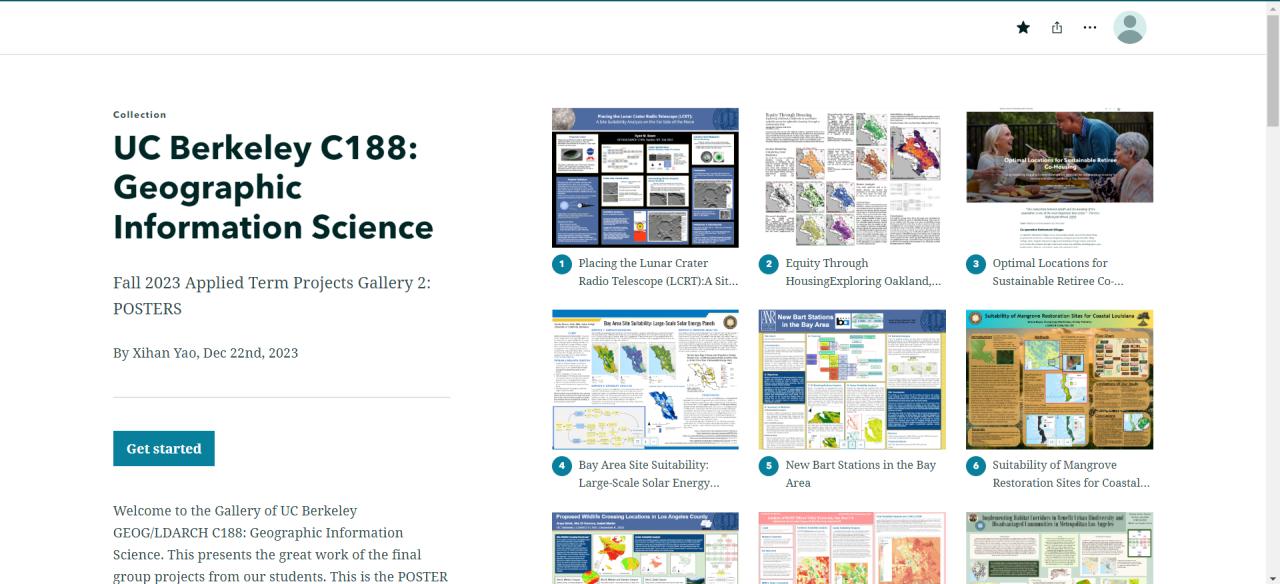
Fall 2023 Applied Term Projects Gallery 2: Final posters demonstrating advanced spatial analysis
Impact: This teaching experience reinforced my commitment to education and my ability to communicate complex geospatial concepts to diverse audiences. Managing a course of this scale taught me invaluable lessons about leadership, curriculum design, and the importance of making GIS accessible and relevant to students from all backgrounds.
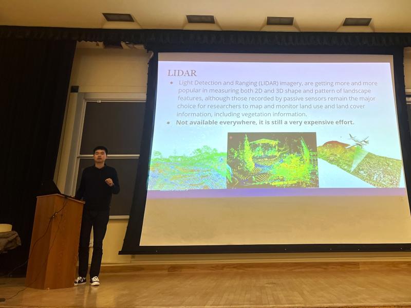
Presenting during a lecture
Graduate Student Instructor
ESPM/LDARCH C289: Applied Remote Sensing
University of California, Berkeley | Spring 2023
Served as a Graduate Student Instructor for this advanced course on remote sensing applications in environmental science and landscape architecture.
Responsibilities:
- Led weekly lab sections teaching practical remote sensing analysis using Google Earth Engine, ENVI, and ArcGIS
- Guided students through hands-on projects on multispectral image analysis, change detection, and vegetation monitoring
- Provided mentoring on final projects applying remote sensing to environmental research questions
- Held office hours and graded assignments, ensuring students developed strong technical skills in image processing and analysis
Teaching Focus:
- Multispectral and hyperspectral image analysis
- Satellite-based vegetation indices and land cover classification
- Time-series analysis for environmental change detection
- Integration of remote sensing with GIS for spatial analysis
GEOG/LDARCH C188: Geographic Information Science
University of California, Berkeley | Fall 2022
Served as a Graduate Student Instructor for the introductory GIS course, where I first developed my teaching skills in geospatial science education.
Responsibilities:
- Facilitated weekly lab sections for 25-30 students, introducing foundational GIS concepts and software (ArcGIS Pro, QGIS)
- Taught spatial data acquisition, management, analysis, and visualization techniques
- Mentored students on lab assignments and provided one-on-one support during office hours
- Assisted in grading and providing constructive feedback on student projects
Teaching Focus:
- Introduction to GIS concepts and coordinate systems
- Spatial data types, structures, and databases
- Geoprocessing, spatial analysis, and cartographic design
- Applied GIS problem-solving for environmental and urban planning challenges